
File:Federation of Rhodesia and Nyasaland map 1960.jpg

預覽大小:556 × 599 像素。 其他解析度:223 × 240 像素 | 445 × 480 像素 | 712 × 768 像素 | 950 × 1,024 像素 | 1,900 × 2,048 像素 | 3,436 × 3,704 像素。
原始檔案 (3,436 × 3,704 像素,檔案大小:9.76 MB,MIME 類型:image/jpeg)
摘要
| 描述 |
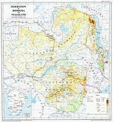
English: A map of the Federation of Rhodesia and Nyasaland, issued by the Government in 1960 |
| 日期 | |
| 來源 | Originally scanned from Government-issue Federal Atlas issued in 1960. Scan taken from Great North Road website. |
| 作者 | Federal Government Printer, Salisbury, Rhodesia and Nyasaland. Copyright owned by the Government of Federation of Rhodesia and Nyasaland |
| 其他版本 |
授權條款
This work was first published in Zimbabwe (or one of its antecedents) and is now in the public domain in Zimbabwe because its copyright protection has expired by virtue of the Copyright and Neighboring Rights Act, enacted 2000 (details). The work meets one of the following criteria:
A Zimbabwean work that is in the public domain in Zimbabwe according to this rule is in the public domain in the U.S. only if it was in the public domain in Zimbabwe in 1996, e.g. if it was published before 1946 and no copyright was registered in the U.S. (This is the effect of the Uruguay Round Agreements Act (17 USC 104A) with its critical date of January 1, 1996.) |
 |
檔案歷史
點選日期/時間以檢視該時間的檔案版本。
| 日期/時間 | 縮圖 | 尺寸 | 使用者 | 備註 | |
|---|---|---|---|---|---|
| 目前 | 2011年11月29日 (二) 05:43 | | 3,436 × 3,704(9.76 MB) | P. S. Burton | removed watermark, and slight crop of frame |
| 2011年10月20日 (四) 09:50 |  | 3,436 × 3,757(2.76 MB) | Renamed user df576567etesddf | restored watermark per request on website; also file is smaller | |
| 2011年10月20日 (四) 09:14 |  | 3,436 × 3,695(9.23 MB) | Renamed user df576567etesddf | {{Information |Description ={{en|1=A map of the Federation of Rhodesia and Nyasaland, issued by the Government in 1960}} |Source =Originally scanned from Government-issue Federal Atlas issued in 1960. Scan taken from [http://www.greatnorthroad. |
檔案用途
沒有使用此檔案的頁面。
全域檔案使用狀況
以下其他 wiki 使用了這個檔案:
- als.wikipedia.org 的使用狀況
- de.wikipedia.org 的使用狀況
- en.wikipedia.org 的使用狀況
- en.wikibooks.org 的使用狀況
- es.wikipedia.org 的使用狀況
- mt.wikipedia.org 的使用狀況
- pl.wikipedia.org 的使用狀況
- tum.wikipedia.org 的使用狀況