
File:BlankMap-World-Subdivisions.PNG
預覽大小:800 × 395 像素。 其他解析度:320 × 158 像素 | 640 × 316 像素 | 1,500 × 740 像素。
原始檔案 (1,500 × 740 像素,檔案大小:118 KB,MIME 類型:image/png)

|
File:Blank Map World Secondary Political Divisions.svg是本檔案的向量版本。 如果品質不低,就應該優先使用該檔案,而非PNG檔案。
File:BlankMap-World-Subdivisions.PNG → File:Blank Map World Secondary Political Divisions.svg
更多資訊請參閱Help:SVG/zh。 |
 |
h
摘要
| 描述 |
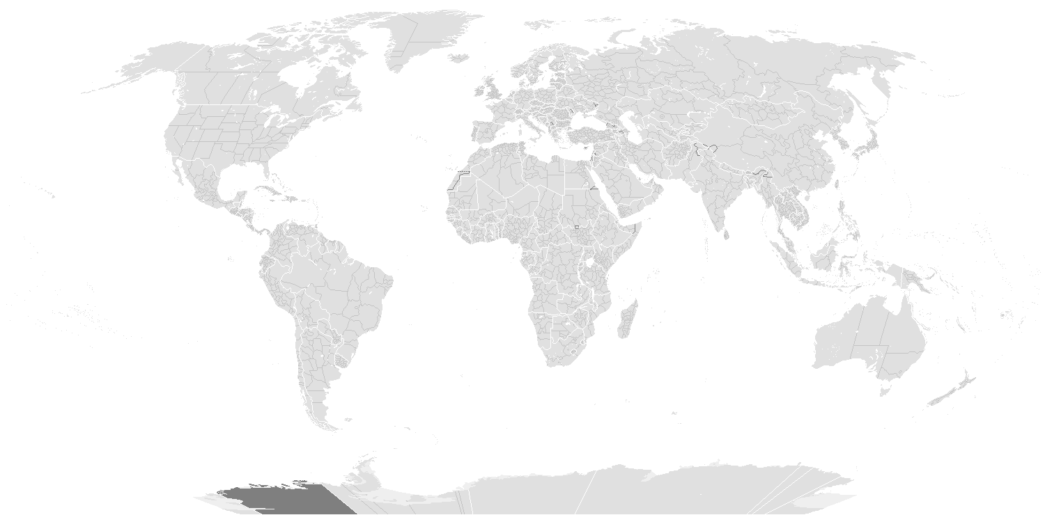
English: A blank world map showing subdivisions of the world. Areas in black boxes are unrecognized countries or disputed territories (Kashmir). Feel free to fix subdivisions (mainly Russia, Mongolia, and Kazakhstan. If you use the subdivision maps for any other image I strongly advise changing the subdivision colours to suit your purposes (eg. In Photoshop use the bucket of paint thing with contiguous and anti-alias turned off and click on any subdivision border with your preferred colour.) The colours chosen here are to differentiate the types of borders, not dictate use.
Français : Carte du monde vierge montrant les subdivisions de premier niveau de chaque pays. Les régions encadrées en noir montrent des États non reconnus ou des territoires disputés (comme le Cachemire. Ne vous gênez pas pour arranger certaines limites de subdivisions — notamment en Russie, en Mongolie et au Kazakhstan. Si vous utilisez cette carte pour faire une autre image, il vous est vivement conseillé d’en changer les couleurs pour qu’elles conviennent à votre usage ; ces couleurs-ci ne sont choisies que pour distinguer les différents types de frontières. |
||
| 日期 | |||
| 來源 |
|
||
| 作者 |
English: see upload log? |
||
| 授權許可 (重用此檔案) |
|
||
| 其他版本 | Derivative works of this file: BlankMap-World-Subdivisions1.png |
Key
|
Water-bodies
Landmasses
Unclaimed Landmasses
National Borders
Subnational Borders
|
Colours
| Name | Decimal | Hex | |
| Water-bodies: | 255,255,255 | #FFFFFF | |
| Landmasses: | 224,224,224 | #E0E0E0 | |
| Unclaimed Landmasses: | 127,127,127 | #7F7F7F | |
| National Borders: | 255,255,255 | #FFFjjj | |
| Subnational Borders: | 202,202,202 | #CACACA |
| 註解 | 該圖片含有註解:在維基媒體共享資源上查看註解 |
檔案歷史
點選日期/時間以檢視該時間的檔案版本。
| 日期/時間 | 縮圖 | 尺寸 | 使用者 | 備註 | |
|---|---|---|---|---|---|
| 目前 | 2020年3月15日 (日) 06:36 | | 1,500 × 740(118 KB) | Dylmur | Reverted to version as of 18:58, 14 March 2020 (UTC) hopefully this works again |
| 2020年3月15日 (日) 03:00 |  | 1,500 × 740(91 KB) | Dylmur | Reverted to version as of 00:56, 29 October 2017 (UTC) didn’t work | |
| 2020年3月15日 (日) 02:58 |  | 1,500 × 740(118 KB) | Dylmur | Ladakh (2019) | |
| 2017年10月29日 (日) 08:56 |  | 1,500 × 740(91 KB) | Erhik | Golan Heights | |
| 2017年10月29日 (日) 08:25 |  | 1,500 × 740(91 KB) | Erhik | Minor adjustments in Oceania, Ukraine. | |
| 2017年10月10日 (二) 19:27 |  | 1,500 × 740(104 KB) | Expertseeker90 | Major overhall to the projection! Continents, coastlines, national boundary and internal boundaries fixed. Islands, atolls and reefs added or adjusted! | |
| 2017年7月5日 (三) 05:34 |  | 1,500 × 740(100 KB) | Forthrunner | Catalonia isn't independent | |
| 2016年7月21日 (四) 17:47 |  | 1,500 × 740(67 KB) | Simonsyo | Added British Regions. | |
| 2016年1月20日 (三) 02:21 |  | 1,500 × 740(67 KB) | Userboker | Added new French regions as of 2016, fixed Catalonia being represented as independent | |
| 2014年12月16日 (二) 22:58 |  | 1,500 × 740(83 KB) | Ransewiki | Did not work last time. |
檔案用途
沒有使用此檔案的頁面。
全域檔案使用狀況
以下其他 wiki 使用了這個檔案:
- de.wikipedia.org 的使用狀況
- Vorwahlergebnisse der Präsidentschaftswahl in den Vereinigten Staaten 2008
- Vorwahlergebnisse der Präsidentschaftswahl in den Vereinigten Staaten 2016
- Vorwahlergebnisse der Präsidentschaftswahl in den Vereinigten Staaten 2020
- Vorwahlergebnisse der Präsidentschaftswahl in den Vereinigten Staaten 2024
- Benutzer:Sarkana/Vorwahlergebnisse 2024
- en.wikipedia.org 的使用狀況
- fr.wikipedia.org 的使用狀況
- sv.wikipedia.org 的使用狀況
- zh.wikipedia.org 的使用狀況