
File:Cook islands map.png
預覽大小:422 × 599 像素。 其他解析度:169 × 240 像素 | 338 × 480 像素 | 540 × 768 像素 | 1,253 × 1,780 像素。
原始檔案 (1,253 × 1,780 像素,檔案大小:352 KB,MIME 類型:image/png)
摘要
| 描述 |
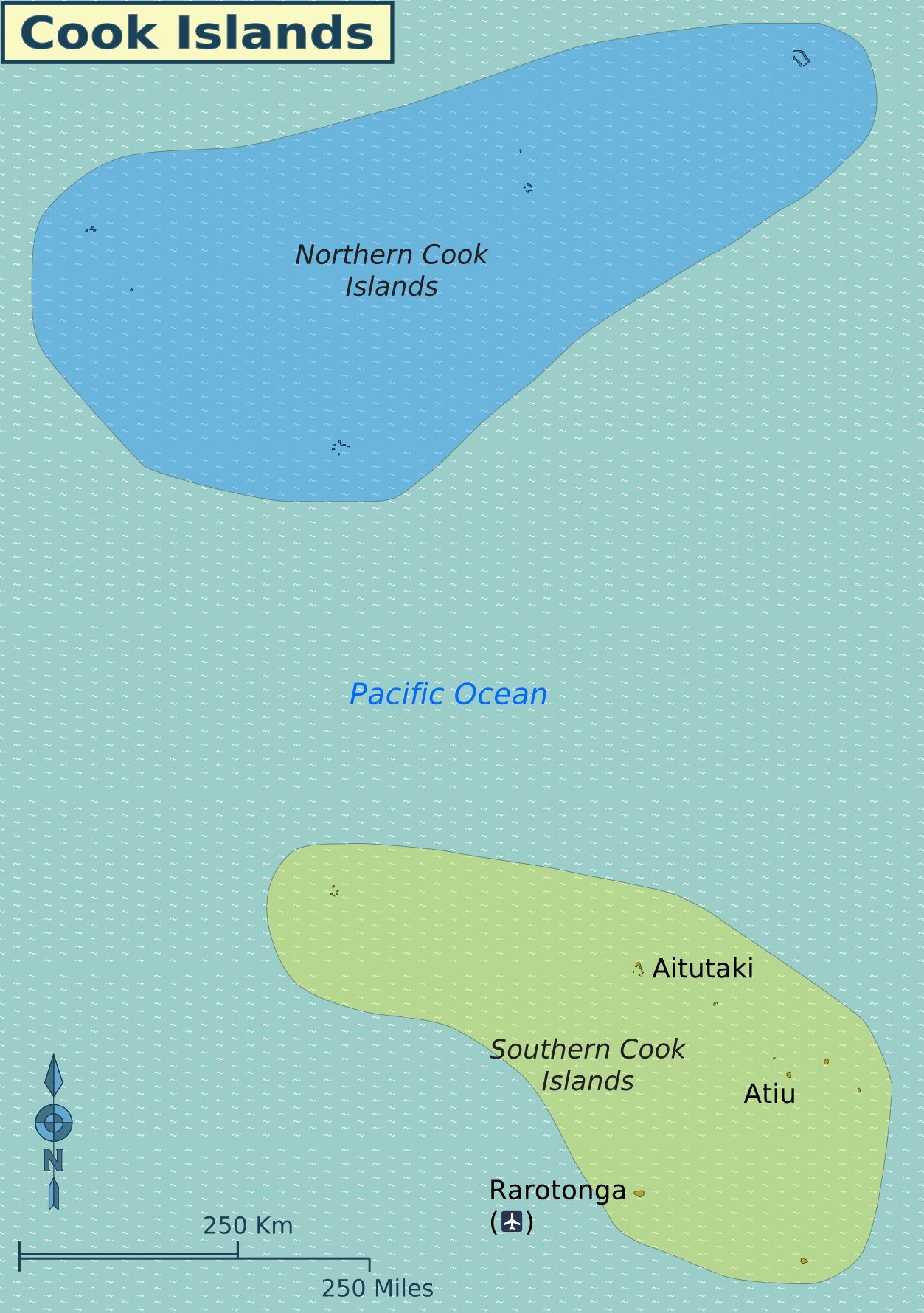
English: Map of the Cook Islands. |
| 日期 | |
| 來源 | Created from SVG version, in turn drawn by (WT-shared) Shaund based on this map from User:Aotearoa. |
| 作者 | User: (WT-shared) Shaund at wts 維基導遊 |
| 其他版本 |
|

授權條款
此檔案採用共享創意 姓名標示-相同方式分享 3.0 未在地化版本授權條款。
- 您可以自由:
- 分享 – 複製、發佈和傳播本作品
- 重新修改 – 創作演繹作品
- 惟需遵照下列條件:
- 姓名標示 – 您必須指名出正確的製作者,和提供授權條款的連結,以及表示是否有對內容上做出變更。您可以用任何合理的方式來行動,但不得以任何方式表明授權條款是對您許可或是由您所使用。
- 相同方式分享 – 如果您利用本素材進行再混合、轉換或創作,您必須基於如同原先的相同或兼容的條款,來分布您的貢獻成品。
原始上傳日誌
| This file was imported from Wikivoyage WTS. |
The original description page was here. All following user names refer to wts.wikivoyage-old.
- 2011-07-27 20:42 (WT-shared) Shaund archive copy at the Wayback Machine 1253×1780 (360711 bytes) {{Imagecredit|credit=[[User:Shaund|Shaund]]|captureDate=27 July 2011|location=Cook Islands|source=[[:Image:Cook islands map.svg]]|caption=Ma (Import from wikitravel.org/shared)
檔案歷史
點選日期/時間以檢視該時間的檔案版本。
| 日期/時間 | 縮圖 | 尺寸 | 用戶 | 備註 | |
|---|---|---|---|---|---|
| 目前 | 2012年11月18日 (日) 07:18 | | 1,253 × 1,780(352 KB) | MGA73bot2 | {{BotMoveToCommons|wts.oldwikivoyage|year={{subst:CURRENTYEAR}}|month={{subst:CURRENTMONTHNAME}}|day={{subst:CURRENTDAY}}}} == {{int:filedesc}} == {{Information |description=Map of the Cook Islands. , Cook Islands * Map of: Cook Islands¤ |date=27 July... |
檔案用途
下列頁面有用到此檔案:
全域檔案使用狀況
以下其他 wiki 使用了這個檔案:
- el.wikivoyage.org 的使用狀況
- en.wikivoyage.org 的使用狀況
- he.wikivoyage.org 的使用狀況
- incubator.wikimedia.org 的使用狀況
- it.wikivoyage.org 的使用狀況
- ja.wikivoyage.org 的使用狀況
- uk.wikipedia.org 的使用狀況