
File:Switzerland-map.png
預覽大小:800 × 517 像素。 其他解析度:320 × 207 像素 | 640 × 413 像素 | 1,024 × 661 像素 | 1,280 × 827 像素 | 2,453 × 1,584 像素。
原始檔案 (2,453 × 1,584 像素,檔案大小:1.07 MB,MIME 類型:image/png)
摘要
| 描述 |
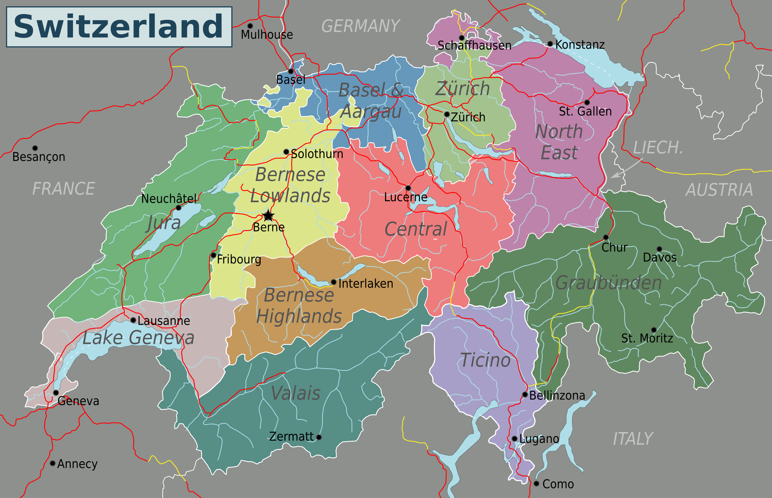
English: Map of Switzerland (PNG). Nota Bene: the regions displayed in this map are not official administrative divisions.
|
| 日期 | |
| 來源 | 自己的作品 based on Suisse cantons.svg by Pymouss44, Switzerland regions.svg by Stefan Ertmann and work by OpenStreetMap.org contributors. |
| 作者 | Globe-trotter |
| 其他版本 | Inkscape SVG |
授權條款
此檔案採用創用CC 姓名標示-相同方式分享 4.0 國際授權條款。
- 您可以自由:
- 分享 – 複製、發佈和傳播本作品
- 重新修改 – 創作演繹作品
- 惟需遵照下列條件:
- 姓名標示 – 您必須指名出正確的製作者,和提供授權條款的連結,以及表示是否有對內容上做出變更。您可以用任何合理的方式來行動,但不得以任何方式表明授權條款是對您許可或是由您所使用。
- 相同方式分享 – 如果您利用本素材進行再混合、轉換或創作,您必須基於如同原先的相同或兼容的條款,來分布您的貢獻成品。
檔案歷史
點選日期/時間以檢視該時間的檔案版本。
| 日期/時間 | 縮圖 | 尺寸 | 使用者 | 備註 | |
|---|---|---|---|---|---|
| 目前 | 2016年5月4日 (三) 13:40 | | 2,453 × 1,584(1.07 MB) | Drat70 | Reverted to version as of 11:04, 16 May 2015 (UTC) as this file is also used by other pages |
| 2016年5月4日 (三) 13:38 |  | 2,462 × 1,590(1.04 MB) | Drat70 | Changed some of the regions as per discussion on the wikivoyage Switzerland talk page. | |
| 2015年5月16日 (六) 19:04 |  | 2,453 × 1,584(1.07 MB) | Globe-trotter | {{Information |description={{en|1=Map of Switzerland (PNG).}} {{Created with Inkscape|IMPORTANT=1}} |date=2015-05-16 |source={{own}} based on Suisse cantons.svg by Pymouss44, [[:File:Switzerland regions.s... |
檔案用途
沒有使用此檔案的頁面。
全域檔案使用狀況
以下其他 wiki 使用了這個檔案:
- en.wikivoyage.org 的使用狀況
- fa.wikivoyage.org 的使用狀況
- hi.wikibooks.org 的使用狀況