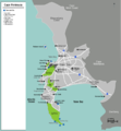
File:Map-South Africa-Western Cape-Cape Peninsula.png

本预览的尺寸:554 × 599像素。 其他分辨率:222 × 240像素 | 444 × 480像素 | 710 × 768像素 | 1,204 × 1,302像素。
原始文件 (1,204 × 1,302像素,文件大小:275 KB,MIME类型:image/png)
文件历史
点击某个日期/时间查看对应时刻的文件。
| 日期/时间 | 缩略图 | 大小 | 用户 | 备注 | |
|---|---|---|---|---|---|
| 当前 | 2012年12月16日 (日) 02:24 |  | 1,204 × 1,302(275 KB) | OgreBot | (BOT): Reverting to most recent version before archival |
| 2012年12月16日 (日) 02:24 |  | 1,204 × 1,302(277 KB) | OgreBot | (BOT): Uploading old version of file from wts.wikivoyage; originally uploaded on 2012-09-11 10:48:57 by Pbsouthwood | |
| 2012年12月16日 (日) 02:24 |  | 1,204 × 1,302(277 KB) | OgreBot | (BOT): Uploading old version of file from wts.wikivoyage; originally uploaded on 2007-03-10 18:42:09 by (WT-shared) NJR ZA | |
| 2012年12月16日 (日) 02:24 |  | 653 × 665(129 KB) | OgreBot | (BOT): Uploading old version of file from wts.wikivoyage; originally uploaded on 2007-01-23 18:14:13 by (WT-shared) NJR ZA | |
| 2012年11月18日 (日) 09:11 |  | 1,204 × 1,302(275 KB) | MGA73bot2 | {{BotMoveToCommons|wts.oldwikivoyage|year={{subst:CURRENTYEAR}}|month={{subst:CURRENTMONTHNAME}}|day={{subst:CURRENTDAY}}}} == {{int:filedesc}} == {{Information |description=Map of Cape Town metropolitan area. Drawn with Inkscape, Post processing in th... |
文件用途
以下页面使用本文件:
全域文件用途
以下其他wiki使用此文件:
- en.wikivoyage.org上的用途

