
File:Azerbaijan (orthographic projection).svg

此SVG文件的PNG预览的大小:551 × 551像素。 其他分辨率:240 × 240像素 | 480 × 480像素 | 768 × 768像素 | 1,024 × 1,024像素 | 2,048 × 2,048像素。
原始文件 (SVG文件,尺寸为551 × 551像素,文件大小:570 KB)
摘要
| 描述 |
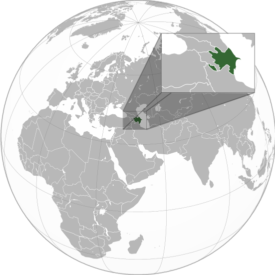
English: Orthographic Projection Map of Azerbaijan.
The other orthographic projection maps. .svg) |
| 日期 | |
| 来源 | 自己的作品 |
| 作者 | en:User:Night w |
.svg)
.svg)
.svg)
.svg)
.svg)
.svg)
.svg)
.svg)
.svg)
.svg)
.svg)
.svg)
.svg)
.svg)
.svg)
.svg)
.svg)
.svg)
.svg)
.svg)
.svg)
.svg)
.svg)
.svg)
.svg)
.svg)
.svg)
.svg)
.svg)
.svg)
.svg)
.svg)
.svg)
.svg)
.svg)
.svg)
.svg)
.svg)
.svg)
.svg)
.svg)
.svg)
.svg)
.svg)
.svg)
.svg)
.svg)
.svg)
.svg)
.svg)
.svg)
.svg)
.svg)
.svg)
.svg)
.svg)
.svg)
.svg)
.svg)
.svg)
.svg)
.svg)
.svg)
.svg)
.svg)
.svg)
.svg)
.svg)
.svg)
.svg)
.svg)
.svg)
.svg)

.svg)

.svg)

.svg)
.svg)
.svg)
.svg)
.svg)
.svg)
.svg)


.svg)
.svg)
.svg)
.svg)
.svg)
.svg)
.svg)

.svg)
.svg)
.svg)
.svg)
.svg)
.svg)
.svg)
.svg)
.svg)

.svg)
.svg)
.svg)
.svg)
.svg)
.svg)
.svg)
_without_national_boundaries.svg)
.svg)
.svg)
.svg)
.svg)
.svg)
.svg)

.svg)
.svg)
.png)
.svg)
.svg)
.svg)
.svg)

.svg)
.svg)
.svg)
.svg)
.svg)
.svg)
.svg)
.svg)
.svg)
.svg)
.svg)

.svg)
.svg)
.svg)
.svg)
.svg)
.svg)
.svg)
.svg)
.svg)

.svg)
.svg)

.svg)
.svg)
.svg)
.svg)
.svg)
.svg)
.svg)
.svg)
.svg)
.svg)
.svg)
.svg)
.svg)
.svg)
.svg)
.svg)
.svg)
.svg)
.svg)
.svg)
.svg)
.svg)
.svg)
.svg)
.svg)
.svg)
.svg)
_-_Crimea_disputed.svg)
.svg)
.svg)
.svg)
.svg)
.svg)
.svg)
.svg)
.svg)
.svg)
.svg)
.svg)
_political.svg)
.svg)
.svg)
.svg)
.svg)
_-_Crimea_disputed_-_no_borders.svg)
.svg)
.svg)
.svg)
.svg)
.svg)
.svg)
.svg)
.svg)
.svg)
.svg)
.svg)

.svg)
.svg)
.svg)

.png)
.svg)
.svg)
.svg)
.svg)
.svg)
.svg)
.svg)
.svg)
.svg)
.svg)
.svg)
.svg)
.svg)
.svg)
.svg)
.svg)
.svg)
.svg)
.svg)
.svg)
.svg)
.svg)
.svg)
.svg)
.svg)
.svg)
.svg)
.svg)
.svg)
.svg)
.svg)
.svg)
.svg)
.svg)
.png)
.svg)
.svg)
.svg)
_(orthographic_projection).png)
.svg)
许可协议
我,本作品著作权人,特此采用以下许可协议发表本作品:

|
已授权您依据自由软件基金会发行的无固定段落及封面封底文字(Invariant Sections, Front-Cover Texts, and Back-Cover Texts)的GNU自由文件许可协议1.2版或任意后续版本的条款,复制、传播和/或修改本文件。该协议的副本请见“GNU Free Documentation License”。 |
本文件采用知识共享署名-相同方式共享 3.0 未本地化版本许可协议授权。
- 您可以自由地:
- 共享 – 复制、发行并传播本作品
- 修改 – 改编作品
- 惟须遵守下列条件:
- 署名 – 您必须对作品进行署名,提供授权条款的链接,并说明是否对原始内容进行了更改。您可以用任何合理的方式来署名,但不得以任何方式表明许可人认可您或您的使用。
- 相同方式共享 – 如果您再混合、转换或者基于本作品进行创作,您必须以与原先许可协议相同或相兼容的许可协议分发您贡献的作品。
您可以选择您需要的许可协议。
原始上传日志
The original description page was on en.wikipedia (file log). All following user names refer to en.wikipedia.
.svg)
- 23:49, 20 April 2011 (UTC) Sisyphos23 551×551 (557 KB)
- 14:15, 15 April 2011 (UTC) Chipmunkdavis 551×551 (568 KB) (Sharpening smaller image)
- 09:57, 15 April 2011 (UTC) Dbachmann 551×551 (577 KB) (suggestion)
- 23:05, 14 April 2011 (UTC) Night w 551×551 (571 KB) (trying to colour)
- 22:58, 14 April 2011 (UTC) Night w 551×551 (575 KB) ({{Information |Description={{en|1=Azerbaijan}} |Source=Own work |Author=Night w |Date=2011-04 |Permission= |other_versions={{User:Ssolbergj/orthographic}} }} == {{int:license}} == {{self|cc-by-sa-3.0|GFDL|migration=redundant}} {{ImageNot)
文件历史
点击某个日期/时间查看对应时刻的文件。
.svg&dir=prev)
.svg&offset=20160827021508)
.svg&offset=&limit=20)
.svg&offset=&limit=50)
.svg&offset=&limit=100)
.svg&offset=&limit=250)
.svg&offset=&limit=500)
| 日期/时间 | 缩略图 | 大小 | 用户 | 备注 | |
|---|---|---|---|---|---|
| 当前 | 2023年3月23日 (四) 09:36 | | 551 × 551(570 KB) | M.Bitton | Reverted to version as of 09:05, 14 September 2022 (UTC): per COM:OVERWRITE |
| 2023年3月22日 (三) 21:56 |  | 689 × 689(445 KB) | Multituberculata | ||
| 2022年9月17日 (六) 07:29 |  | 551 × 551(570 KB) | M.Bitton | Reverted to version as of 09:05, 14 September 2022 (UTC): per COM:OVERWRITE | |
| 2022年9月17日 (六) 05:54 |  | 689 × 689(445 KB) | Hogweard | Issues fixed - and South Sudan border added | |
| 2022年9月14日 (三) 17:05 |  | 551 × 551(570 KB) | Toghrul R | Reverted to version as of 15:45, 29 August 2016 (UTC) the Middle East region and Europe were broken, reverting to the previous version without South Sudan; waiting for the fix | |
| 2019年12月14日 (六) 02:00 |  | 551 × 551(421 KB) | Goran tek-en | Added border for South Sudan as requested by {{u|Maphobbyist}} | |
| 2016年8月29日 (一) 23:45 |  | 551 × 551(570 KB) | Artoxx | Reverted to version as of 15:31, 19 April 2016 (UTC) | |
| 2016年8月29日 (一) 23:44 |  | 551 × 551(190 KB) | Artoxx | Reverted to version as of 02:15, 27 August 2016 (UTC) | |
| 2016年8月27日 (六) 10:16 |  | 551 × 551(190 KB) | MosMusy | Georgia and Moldova have their main maps with territories not under control shaded. | |
| 2016年8月27日 (六) 10:15 |  | 551 × 551(190 KB) | MosMusy | Moldova and Georgia's map all have shading for territory not under their government's control. |
文件用途
没有页面使用本文件。
全域文件用途
以下其他wiki使用此文件:
- af.wikipedia.org上的用途
- ami.wikipedia.org上的用途
- arc.wikipedia.org上的用途
- ar.wikipedia.org上的用途
- قائمة الدول ذات السيادة والأقاليم التابعة في آسيا
- مستخدم:جار الله/قائمة صور مقالات العلاقات الثنائية
- العلاقات الأذربيجانية الأمريكية
- العلاقات الأذربيجانية الأنغولية
- العلاقات الأذربيجانية الكورية الجنوبية
- العلاقات الأذربيجانية الإريترية
- العلاقات الأذربيجانية السويسرية
- العلاقات الأذربيجانية الألمانية
- العلاقات الأذربيجانية الليختنشتانية
- العلاقات الأذربيجانية البوليفية
- العلاقات الأذربيجانية الموزمبيقية
- العلاقات الأذربيجانية الألبانية
- العلاقات الأذربيجانية البلجيكية
- العلاقات الأذربيجانية الإثيوبية
- العلاقات الأذربيجانية البيلاروسية
- العلاقات الأذربيجانية الطاجيكستانية
- العلاقات الأذربيجانية الرومانية
- العلاقات الأذربيجانية الأرجنتينية
- العلاقات الأذربيجانية الغامبية
- العلاقات الأذربيجانية القبرصية
- العلاقات الأذربيجانية السيراليونية
- العلاقات الأذربيجانية النيبالية
- العلاقات الأذربيجانية الليبيرية
- العلاقات الأذربيجانية التشيكية
- العلاقات الأذربيجانية الميانمارية
- العلاقات الأذربيجانية الكندية
- العلاقات الأذربيجانية الزيمبابوية
- العلاقات الأذربيجانية البالاوية
- العلاقات الأذربيجانية النيجيرية
- العلاقات الأذربيجانية اليمنية
- العلاقات الأذربيجانية الفانواتية
- العلاقات الأذربيجانية الغابونية
- العلاقات الأذربيجانية البنمية
- العلاقات الأذربيجانية الكوبية
- العلاقات الأذربيجانية الجورجية
- العلاقات الأذربيجانية التونسية
- العلاقات الأذربيجانية الكورية الشمالية
- العلاقات الأذربيجانية الهندية
- العلاقات الأذربيجانية اليابانية
- العلاقات الأذربيجانية الإيطالية
- العلاقات الأذربيجانية الناوروية
- العلاقات الأذربيجانية الأسترالية
- العلاقات الأذربيجانية الزامبية
- العلاقات الأذربيجانية الفيجية
- العلاقات الأذربيجانية المارشالية
- العلاقات الأذربيجانية المالية
查看本文件的更多全域用途。
.svg)
.svg)