
File:Aerial photograph of Helmand River at Gereshk in 2011.jpg
本预览的尺寸:800 × 531像素。 其他分辨率:320 × 212像素 | 640 × 425像素 | 1,024 × 680像素 | 1,280 × 850像素 | 2,784 × 1,848像素。
原始文件 (2,784 × 1,848像素,文件大小:3.95 MB,MIME类型:image/jpeg)
摘要
| 描述 |
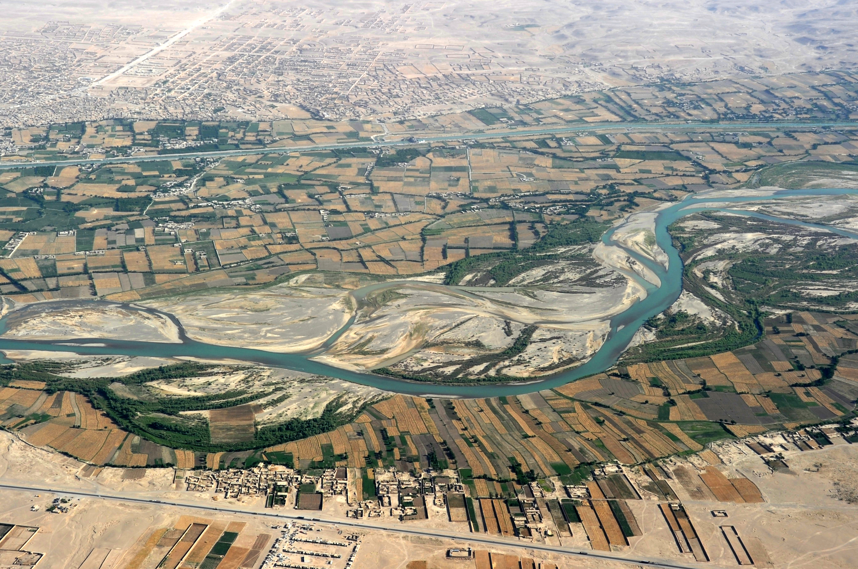
English: Traveling by helicopter enables us to see the beauty of Helmand River with the Boghra Irrigation Canal (Nahr-e Bughra) in the middle distance and the town of Gereshk (Grishk) in the far distance, Helmand Province. |
| 日期 | |
| 来源 | https://www.flickr.com/photos/usace-tas/8713418682/in/photostream/ |
| 作者 | Karla Marshall |
| 相机位置 | | 在以下服务上查看本图像和附近其他图像: OpenStreetMap |
|---|
许可协议
This image or file is a work of a U.S. Army Corps of Engineers soldier or employee, taken or made as part of that person's official duties. As a work of the U.S. federal government, the image is in the public domain.
|
文件历史
点击某个日期/时间查看对应时刻的文件。
| 日期/时间 | 缩略图 | 大小 | 用户 | 备注 | |
|---|---|---|---|---|---|
| 当前 | 2013年5月21日 (二) 22:14 | | 2,784 × 1,848(3.95 MB) | Officer | {{Information |Description={{en|Traveling by helicopter enables us to see the beauty of Kandahar province from the air. (USACE Photo by Karla Marshall)}} |Source=http://www.flickr.com/photos/usace-tas/8713418682/in/photostream/ |Date=2011-05-30 |Author... |
文件用途
以下页面使用本文件:
全域文件用途
以下其他wiki使用此文件:
- ar.wikipedia.org上的用途
- azb.wikipedia.org上的用途
- bn.wikipedia.org上的用途
- bs.wikipedia.org上的用途
- ca.wikipedia.org上的用途
- ceb.wikipedia.org上的用途
- cs.wikipedia.org上的用途
- cy.wikipedia.org上的用途
- da.wikipedia.org上的用途
- el.wikipedia.org上的用途
- en.wikipedia.org上的用途
- en.wikivoyage.org上的用途
- en.wiktionary.org上的用途
- eo.wikipedia.org上的用途
- es.wikipedia.org上的用途
- eu.wikipedia.org上的用途
- fa.wikipedia.org上的用途
- fi.wikipedia.org上的用途
- fr.wikipedia.org上的用途
- gu.wikipedia.org上的用途
- he.wikipedia.org上的用途
- hu.wikipedia.org上的用途
- hy.wikipedia.org上的用途
- id.wikipedia.org上的用途
- incubator.wikimedia.org上的用途
- it.wikipedia.org上的用途
- kab.wikipedia.org上的用途
- ka.wikipedia.org上的用途
- kk.wikipedia.org上的用途
查看本文件的更多全域用途。